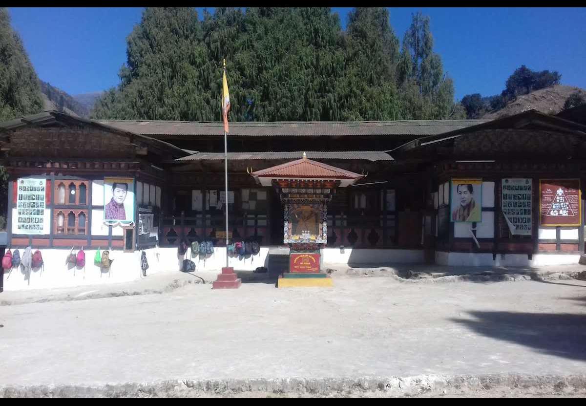
Gewog at a Glance
Gewog Profile (Description):
At an altitude ranging from 2600 to 3500 meters above sea level, Saephoog gewog is situated en-route to Trongsa, located north eastern part of Wangduephodrang dzongkhag. One can reach Saephoog gewog centre after three hours’ drive from Wangdue dzongkhag by passing the rough highway road, made due to the stone quarry and road widening along the highway. The gewog compromises of five chiwogs (Buso-Zeri, Rukubjee, Longtoed, Bumilog and Nakha) with the total of 331 households and 1505 population. Saephoog consists of an estimated area of 110801.221758 ha, which is highest among the other gewogs under Wangdue. The chiwogs are scattered each other but the households under individual chiwogs are nucleated.
Saephoog Gewog enjoys a temperate climate with mostly rugged terrain and snow fall during winter. The Gewog has high potential for livestock and has established one milk processing unit one at Rukubjee. Potato cultivation dominates among the agriculture farming activities and most of the productions were sold to Punatshangchu project through farmers group.
During the cordyceps season (June) the villagers used to migrate to the highland for cordyceps collection leaving behind those who can’t afford to walk. The Gewog Administration used to issue three permits per household for the duration of one month. It is one of the main sources of income for Saephoog farmers.
Most of the villages under Saephoog enjoy the basic needs like electricity, rural water supply scheme, farm road and telecommunication. Total the Gewog has connected 53.032 km of farm roads to villages as of now, which made it easier for farmers to transport their products to the nearest market.
The government infrastructure like schools, RNR and Basic health unit were also established for service delivery. Community banking with the facilities like cash transaction (BDBL only), photocopy, half photo and on-line services was operational in the year 2013 with one operator where it benefits the farmers in terms of time consumption and transportation expenses.
Out of 7 communities and 1 private owned lhakhang, The WangdueGoenpa lhakhang has a monastic education center at present.
|
Local Government |
||||||
|
Gewog Name: |
Saephoog |
|||||
|
Geographical Location |
|
|||||
|
Total Area (sq.kms) |
110801.221758 ha, |
|||||
|
་ Total No. of Chiwog |
5 |
|||||
|
GT Member |
Name |
Designation |
Gender |
Remarks |
||
|
Rinchen Penjor |
Gup |
Male |
|
|||
|
Sangay Dorji |
Magmi |
Male |
|
|||
|
Passang |
Tshogpa |
Male |
Bumilog |
|||
|
Tashi Dorji |
Tshogpa |
Male |
Buso |
|||
|
Kumbu Dorji |
Tshogpa |
Male |
Longtoed |
|||
|
Phurba |
Tshogpa |
Male |
Nakha |
|||
|
Dawa Tshering |
Tshogpa |
Male |
Rukubjee |
|||
|
Community center |
1 (Gewog Center) |
|||||
|
Total Population |
Male |
Female |
Total |
|||
|
675 |
830 |
1505(Data collected through health annual census) |
||||
|
Total No. of Villages |
20 |
|||||
|
No. of Households |
331 |
|||||
|
Business License Holder |
16 |
|||||
|
Household with BBS and cable TV |
280 |
|||||
|
Agriculture |
||
|
RNR extension centers |
1 |
|
|
Farmer’s Group |
3 (Nakha Samdrup Tshonglay Detshen/ Sephu Phuensum Tshetshey Detshen/ Rubjib- Bumilo Gonor Namdrel Detshen) |
|
|
Irrigation schemes |
Number |
KMS |
|
0 |
0 |
|
|
No of Community forest |
7 ( 2 are in Pending, Nakha and Longmaed) (5 approved, Longroed, Gangchukha, Bumilog, Rukubjee and Wangoen) |
|
|
Total Forest Coverage |
|
|
|
Education |
|||||||||||
|
No. of Schools |
HSS |
MSS |
PS |
ECR |
NFE |
TOTAL |
|||||
|
|
|
2 |
|
1 |
3 |
||||||
|
No. of Students |
Boys |
Girls |
Boys |
Girls |
Boys |
Girls |
Boys |
Girls |
Male |
Female |
Total |
|
|
|
|
|
|
|
|
|
|
|
|
|
|
Rukubjee PS |
|
|
|
|
64 |
60 |
|
|
|
5 |
124 |
|
Sephu PS |
|
|
|
|
60 |
50 |
|
|
|
|
110 |
|
No. of Teachers |
M |
F |
M |
F |
M |
F |
M |
F |
M |
F |
Total |
|
|
|
|
|
6 |
6 |
|
|
1 |
0 |
12 |
|
|
Teacher student ratio |
School……1:19/ NFE………1:5 |
||||||||||
|
Health |
|||||||
|
Hospital/BHUs/ORCs |
Hospital |
་ BHU |
ORC |
Total |
|||
|
0 |
1 |
2 |
3 |
||||
|
RWSS Coverage |
No. Household With RWSS coverage |
Percentage (%) |
No. of Household Without RWSS coverage |
Percentage (%) |
|||
|
325 |
98.6% |
6 (Temporary Shed and New construction house) |
1.4% |
||||
|
Electricity |
|||||
|
Household electrified |
No. |
% |
Household without Electrified |
No. |
% |
|
331 |
100% |
0 |
0% |
||
|
Tele-communication |
|
|
Village with Mobile network |
20 (B-Mobile and Tashi Cell) |
|
Village without mobile network |
0 |
|
Roads Networks |
|
|
GC Roads (KMS) |
|
|
Farm Roads (KMS) |
53.032 KM |
|
Religion & Culture |
||||
|
Lhakhangs |
Govt. Owned |
Community |
Private |
Total |
|
|
7 |
1 |
8 |
|
|
Local Government |
||||
|
Village Name Population |
Village |
Male |
Female |
་Total |
|
1. Rukubjee |
58 |
69 |
127 |
|
|
2. Chazam |
17 |
20 |
37 |
|
|
3. Daliting |
12 |
15 |
27 |
|
|
4. Meri |
4 |
5 |
9 |
|
|
5. Phenchimeri |
10 |
15 |
25 |
|
|
6. Bumilog |
90 |
107 |
197 |
|
|
7. Rivana |
41 |
40 |
81 |
|
|
8. Longmaed |
17 |
20 |
37 |
|
|
9. Longtoed |
14 |
18 |
22 |
|
|
10. Gangchukha |
32 |
35 |
67 |
|
|
11. Dechenphakha |
42 |
58 |
100 |
|
|
12. Nongtru |
50 |
58 |
108 |
|
|
13. Lubzur |
70 |
67 |
137 |
|
|
14. Darilog |
30 |
41 |
71 |
|
|
15. Wangdue Goenpa |
38 |
57 |
95 |
|
|
16. Buso |
57 |
61 |
118 |
|
|
17. Zeri |
28 |
52 |
80 |
|
|
18. Lamji |
22 |
29 |
51 |
|
|
19. Nakha |
24 |
42 |
66 |
|
|
20. Serthang |
19 |
31 |
50 |
|
|
Total…………………… |
675 |
830 |
1505 |
|
Civil Infrastructure
|
Sl |
Name |
Year of const. |
Remarks/Issues |
|||||||
|
1 |
Gewog Office |
2008 |
|
|||||||
|
2 |
RNREC |
2009 |
|
|||||||
|
3 |
BHU/Hospitals/ORC |
1990 |
|
|||||||
|
4 |
Forest Range Office |
----- |
|
|||||||
|
5 |
Park Office (Wangchuk Centennial Park) |
2011 |
|
|||||||
|
6 |
Community Center |
2013 |
Community Banking service is also availed. |
|||||||
|
7 |
Farmers Shop |
2016 |
Used to sell necessary items and Agriculture tools. |
|||||||
|
8 |
Rukubjee Primary School |
1990 |
|
|||||||
|
9 |
Sephu Primary School |
1991 |
|
|||||||
|
No. of Farm Roads |
||||||||||
|
Sl |
Name |
Length (KM) |
Const. Year |
Remarks |
||||||
|
1 |
Boosa to Loobzor farm road |
3.00 |
2010-11 |
|
||||||
|
2 |
Boosa to Lamji farm road |
2.00 |
2011 |
|
||||||
|
3 |
Chenjapokto to Ribana farm road |
5.00 |
2011-2012 |
|
||||||
|
4 |
Boosa to Zeri farm road |
4.00 |
2011-2012 |
|
||||||
|
5 |
Chazam to Boosa farm road |
3.90 |
2005 |
|
||||||
|
6 |
Rukubji approach road |
1.00 |
------ |
|
||||||
|
7 |
Zamdangri to Wangoen farm road |
2.90 |
2011 |
|
||||||
|
8 |
Chazam to Nakha farm road |
9.50 |
------- |
|
||||||
|
9 |
Gangchudor to Gangchukha farm road |
2.00 |
2011 |
|
||||||
|
10 |
Choreygang to Serthang farm road |
1.8 |
2014-15 |
|
||||||
|
11 |
Dechenphakha to Longtoed farm road |
1.8 |
2014-15 |
|
||||||
|
12 |
Gakeythang to Dharilo |
2.0 |
2015- |
|
||||||
|
13 |
NPH to Longtoed Lhakhang |
1.50 |
2012 |
|
||||||
|
14 |
NPH to Bumilog Lhakhang |
0.22 |
2011 |
|
||||||
|
15 |
Rabo to Rabtse Goenpa |
1.5 |
2014-2015 |
|
||||||
|
16 |
Lubzur to Lubzurphakha |
0.85 |
2016-2017 |
|
||||||
|
17 |
NPH(Phenchimeri) to Daliting |
2.5 |
2016-2017 |
|
||||||
|
18 |
NPH(Phenchimeri) to Namichen village |
2.262 |
2015-2016 |
|
||||||
|
19 |
Rukubjee to Saechae via Brogona |
4.8 |
2016-2017 |
Under-Construction |
||||||
|
20 |
Tazagang to Buso-Dangri |
0.50 |
2011-2012 |
|
||||||
|
|
Total FR connected within Saephoog Gewog. |
53.032 |
|
|
||||||
|
Livelihood |
||||||||||
|
Sl |
Name of the crop/livestock |
Annual Production |
Remarks/ Issues |
|||||||
|
1. |
Yak/Cattle |
233.44 MT |
Butter, Cheese and Milk |
|||||||
|
2. |
Cordyceps |
78.842 Kg |
|
|||||||
|
3 |
Potato |
913.34 MT |
|
|||||||
|
4 |
Vegetables (Radish/Cabbage) |
179.18 MT |
|
|||||||
Cultural monuments
|
Sl |
Name of Lhakhang |
Description |
|
1 |
Dechen Goenpa |
Owned by group of five households from Longtoed. |
|
2 |
Wangdue Goenpa |
Owned by Buso Trulku. (monastic center) |
|
3 |
Rukubjee |
Community |
|
4 |
Bumilog |
Community |
|
5 |
Dechenphakha |
Community |
|
6 |
Rabtse Goenpa |
Owned by Buso Trulku (Retreat Center) |
|
7 |
Chenji Pokto |
Owned by Buso Trulku (Monastic center) |
|
8 |
Gangchukha |
Community. |
Bridge
|
Sl no |
Name and Type of bridge |
Year of construction |
Remarks |
|
1 |
Zeri RCT girder Bridge |
2015 |
|
|
2 |
Darilog Bailey Bridge |
2015 |
|
|
3 |
Longmaed wooden Bridge |
2015 |
|
|
4 |
Chazam |
1982 |
|
|
5 |
Motor able Bailey Bridge |
2017 |
Under-construction. |