|
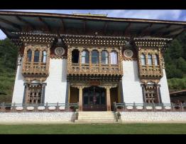
Local Government |
|||||
|
Gewog Name |
Bjena Gewog |
||||
|
Geographical Location |
1350-3400 m above sea level |
||||
|
Total Area |
44,057.93 Acres |
||||
|
Total No. of Chiwog |
5 chiwogs |
||||
|
GT member |
Name |
Designation |
Gender |
||
|
Khandu |
Gup |
Male |
|||
|
Kinley Tawchung |
Mangmi |
“ |
|||
|
Sonam Dema |
Wachhey Tshogpa |
“ |
|||
|
Rinchen Dendup |
Tashi Tokha Tsogpa |
“ |
|||
|
Kinley Gyeltshen |
Garzhikha Tshogpa |
“ |
|||
|
Tshewang Tashi |
Bjenaloongpa “ |
“ |
|||
|
Tshering Nidup |
Ngawang Tongchennang “ |
“ |
|||
|
Community Centre |
1 no |
||||
|
Total Population |
Male |
female |
Total |
||
|
1220 |
1250 |
2470 |
|||
|
Total No. of Village |
5 |
||||
|
No of Household |
319 |
||||
|
Business license Holder |
5 |
||||
|
Agriculture |
||
|
RNR extension center |
1 no |
|
|
Farmers cooperatives |
2 nos |
|
|
Irrigation Schemes
|
Numbers |
KMS |
|
36 |
24 |
|
|
Total Forest Coverage |
43.40/- |
|
|
Education |
|||||||||||||||||
|
No. of school |
HSS |
MSS |
PS |
ECR |
NFC |
TOTAl |
|||||||||||
|
nil |
Nil |
2 |
nil |
nil |
2 |
||||||||||||
|
No. of student |
Boys |
Girls |
Boys |
Girls |
Boys |
Girls |
Boys |
Girls |
Boys |
Girls |
|
||||||
|
|
|
|
|
118 |
107 |
|
|
|
|
225 |
|||||||
|
No. of Teachers |
|
|
|
|
7 |
6 |
|
|
|
|
13 |
||||||
|
|
|
|
|
|
|
|
|
|
|
|
|||||||
|
Teacher and student ratio |
|
||||||||||||||||
|
Health |
||||||
|
Hospital/BHUs/ORCs |
Hospital |
BHU |
ORC |
Total |
||
|
Nil |
2 |
2 |
4 |
|||
|
RWSS Coverage |
No. household |
Percentage (%) |
No. of household |
Percentage (%) |
||
|
365 |
99% |
365 |
99% |
|||
|
Electricity |
|||||
|
Household electrified |
No. |
% |
Household without Electrified |
No |
% |
|
370 |
100/ |
nil |
|
||
|
Tele-communication |
|
|
Village with Mobile network |
100/- coverage |
|
Village without Mobilenetwork |
Nil |
|
Roads Networks |
|
|
GC Road (KMS) |
1 km from main road |
|
Farm Road (KMS) |
55 km (Including Themakha feeder road and Khotokha road) |
|
Religion and Culture |
||||
|
Lhakhangs |
Govt.Owned |
Community |
Private |
Total |
|
4 |
5 |
4 |
13 |
|
Local Government
|
Total village |
1. Tashi Tokha |
|||
|
2. Themakha |
||||
|
3. Wachey |
||||
|
4. Garzhikha |
||||
|
5. Ngawang |
||||
|
Village |
||||
|
Tashi Tokha |
||||
|
Themakha |
||||
|
Wachey |
||||
|
Population |
Garkzhikha |
Male |
Female |
Total |
|
Ngawang |
220 |
245 |
465 |
|
|
|
276 |
313 |
589 |
|
|
|
301 |
294 |
595 |
|
|
|
195 |
123 |
318 |
|
|
|
210 |
284 |
494 |
|
|
|
|
|
|
|
Civil Infrastructure
|
Sl |
Name |
Year of const. |
Remarks |
|
1 |
Gewog office |
2009 |
|
|
2 |
RNR |
2003 |
|
|
3 |
BHU/ORC |
2007 |
|
|
4 |
Forest Rang office |
|
|
No of Farm Road
|
SL |
name |
Length |
Const. year |
Remarks |
|
1 |
Themakha to Lamtog |
1 |
|
|
|
2 |
Themakha to Balakha |
1 |
|
|
|
3 |
Tashitokha to Puntshogang |
1.8 |
2015-16 |
|
|
4 |
Nalagang to Ngawang |
|
|
|
|
5 |
Dugsalo to Khotokha CPS |
1 |
|
|
|
6 |
Khujuna to Tokha |
|
|
|
|
7 |
Pachu to Pangmarpo |
1.5 |
|
|
|
8 |
Pachu to Garzhikha |
3 |
|
|
|
9 |
Garzhikha to Omchengang |
1 |
|
|
|
10 |
|
|
|
|
Livelihood
|
sl |
Name of the crop/livelihood |
Annual Production (MT) |
Remarks/issue |
|
1 |
Rice |
474 |
|
|
2 |
Wheat |
41.54 |
|
|
3 |
Potato |
1485 |
|
|
4 |
Vegetable |
210 |
|