Nyisho
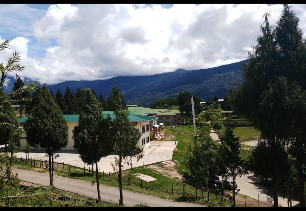
Nyisho Geog is located towards the east from the Wangdue Dzongkhag. The Geog consists of 6 chiwogs with the total of 24 villages (Chuzomsa, Chebakha, Kuenzangling, Chimsiling, Gelekha, Lekokha, Nyishokha, Chitokha, Pangkha, Samtengang, Ganju, Lukchu, Chedalo, Zhingsarbu, Phadekha, Daku, Phatsitokha, Khamena, Rajawog, Tangkakha, Lokhache, Zill, Wompokha, Goga).
|
Local Government |
|||
|
Geog Name |
Nyisho Geog |
||
|
Geographical Location |
(1880-1986 meter above sea level) |
||
|
Total Area (sq. kms) |
115.51 Sq. Km |
||
|
Total No. of Chiwog |
6
|
||
|
Community center |
1 |
||
|
Total Population |
Male |
Female |
Total |
|
1328 |
1323 |
2651 |
|
|
|
|
|
|
|
Total No. of Villages |
13 |
|
|
|
No. of Households |
341 |
|
|
|
Business License Holder |
10 |
||
|
Agriculture |
|
|
|
RNR extension centers |
1 NO. |
|
|
Farmer’s cooperatives |
|
|
|
Irrigation Schemes |
Number |
KMS |
|
6 Nos. |
35 Km |
|
|
Total Forest Cover |
82.5% |
|
|
Education |
|||||||||||
|
No. of Schools |
HSS |
MSS |
PS |
ECR |
NFE |
Total |
|||||
|
|
1 |
|
|
3 |
4 |
||||||
|
No. of students |
Boys |
Girls |
Boys |
Girls |
Boys |
Girls |
Male |
Female |
Male |
Female |
Total |
|
|
|
342 |
396 |
|
|
|
|
3 |
20 |
741 |
|
|
No. of Teachers |
M |
F |
M |
F |
M |
F |
M |
F |
M |
F |
Total |
|
|
|
23 |
16 |
|
|
|
|
1 |
2 |
42 |
|
|
Teacher Student ratio |
1:19 |
||||||||||
|
Health |
||||
|
Hospital/BUUs/ORCs |
Hospital
|
BHU |
ORC |
Total |
|
|
1 |
2 |
3 |
|
|
་ RWSS Coverage |
No. of household |
Percentage (%) |
No. of Household |
Percentage (%) |
|
322 |
100% |
|||
|
Electricity |
|||||
|
Household electrified |
No. |
% |
Household with electrified |
No. |
% |
|
322 |
100% |
Nil |
Nil |
0% |
|
|
Tele-communication |
|
|
Village with Mobile network |
All connected |
|
Village without Mobile network |
Nil |
|
Roads Networks |
|
|
GC Roads (KMS) |
9 Km (From Chuzomsa) |
|
Farm Roads (KMS) |
40.8km |
|
Religion and Culture |
||||
|
Lhakhangs |
Govt. owned |
Community |
Private |
Total |
|
1 |
5 |
3 |
9 |
|
No. of Farm roads
|
Sl. No. |
Name |
Length |
Year of Const. |
Remarks |
|
Gelekha farm road
|
1.6 km |
2005 |
|
|
|
Phadekha farm road |
6km |
2008 |
|
|
|
Zhingsarbu farm road |
1.3km |
2009 |
|
|
|
Nyishokha farm road
|
2.2km |
2010 |
|
|
|
Samtengang farm road
|
0.4km |
2010 |
|
|
|
Kuenzangling farm road
|
1.6km |
2010 |
|
|
|
|
Rajawo farm road
|
6km |
2011 |
|
|
Pangkha
|
6km |
2012 |
|
|
|
Gangjab
|
|
2012 |
|
|
|
|
Chebakha farm road
|
0.7km |
2012 |
|
|
|
Chimsiling farm road |
1.2km |
2013 |
|
|
Lhakhangthangkha farm road |
0.8km |
2014 |
|
|
|
Gotsa farm road |
2km |
2014 |
|
|
|
Chedalo farm road |
3km` |
2014 |
|
|
|
Daku Khamena farm road |
7.3 |
2015 |
Schools
|
Sl. No. |
Name |
Number of Students |
No. of Teachers |
Supporting staff |
||
|
Male |
Female |
Male |
Female |
|
||
|
|
Samtengang Central School |
342 |
396 |
23 |
16 |
14 |
Livelihood
|
Sl. No. |
Name of the crop/livestock |
Annual Production
|
Remarks/ Issues |
|
1 |
Paddy Production |
394 MT |
|
|
2 |
Wheat Production |
43.59 MT |
|
|
3 |
Potato Production |
316.57 MT |
|
|
4 |
Vegetable Production |
176.78 MT |
|
|
5 |
Milk Production |
96.51 MT |
|
|
6 |
Cheese Production |
8.69 MT |
|
|
7 |
Butter Production |
4.83 MT |
|
|
8 |
Egg Production |
11.25 Dozens |
Institutions
Staff


Tourism
No tourist destinations in this Gewog.
Contact us
- Dzongkhag Administration Wangdue Phodrang, Bhutan
- Dzongdag Post Box No: 1305
- PABX:02-481408/02-481686
- Fax No: 02-481380

