Gewog Profile (Description):
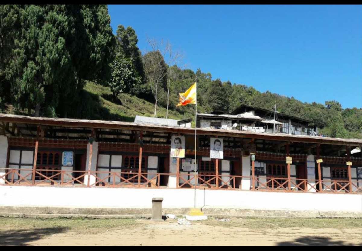
Daga geog is located in the southern part of the Dzongkhag on the right bank of the Puna Tsangchhu. It is bordered by Gasetsho-Wom in the North-West, Lajab Geog and Tseza Geog of Dagana in the South and river Puna Tsang chhu forms its eastern boundary. Daga geog is made up of 5 villages namely Um Khatey, Um Khamey, Wogayna, Gebaykha, Taksha-Silli and it consists of 152 households. As per the PHCB 2005, the population is 1,347.
Daga geog consists of an estimated area of 343.5 Sq.km and about 98% of the total area falls under forest cover. Daga geog enjoys a dry sub-tropical climate with an altitude ranging from 800 to 2700 meters above sea level with an annual average rainfall of 800-900 mm. The average mean temperature for the warmest months of June and July is about 36 degree Celsius, while the mean temperature for the coldest months of January and February is about 10-12 degree Celsius.
|
Local Government |
||||||
|
Gewog Name: |
Daga Gewog |
|||||
|
Geographical Location |
800 to 2700 meters above sea level |
|||||
|
Total Area (sq.kms) |
343.63 |
|||||
|
་ Total No. of Chiwog |
5 |
|||||
|
GT Member |
Name |
Designation |
Gender |
remarks |
||
|
Nado |
Gup |
Male |
|
|||
|
Sonam Lham |
Mangmi |
Female |
|
|||
|
Tshering Penjor |
Uma Khamaed Tshogpa |
Male |
|
|||
|
Dorji |
Kamina Wogyal Tshogpa |
Male |
|
|||
|
Lhatu |
Sili Taagsha Tshogpa |
Male |
|
|||
|
Kuchu |
Uma Khatoed Tshogpa |
Male |
|
|||
|
|
|
|
|
|||
|
Community center |
Daga CC |
|||||
|
Total Population |
Male |
Female |
Total |
|||
|
684 |
663 |
1347 |
||||
|
Total No. of Villages |
35 Vilages |
|||||
|
No. of Households |
152 |
|||||
|
Business License Holder |
15 |
|||||
|
Household with BBS and cable TV |
26 households with BBS tv – no cable TV at village |
|||||
|
Agriculture |
||
|
RNR extension centers |
One centre |
|
|
Farmer’s cooperatives |
Nil |
|
|
Irrigation schemes |
Number |
KMS |
|
11 |
52.5 kms |
|
|
No of Community forest |
2 (Taksha & Uma community forest) |
|
|
Total Forest Coverage |
86.09 percentage |
|
|
Education |
|||||||||||
|
No. of Schools |
HSS |
MSS |
PS |
ECR |
NFE |
TOTAL |
|||||
|
-NA |
NA |
2 |
Nil |
3 |
5 |
||||||
|
No. of Students |
Boys |
Girls |
Boys |
Girls |
Boys |
Girls |
Boys |
Girls |
Male |
Female |
Total |
|
|
|
|
|
107 |
126 |
|
|
|
|
|
|
|
No. of Teachers |
M |
F |
M |
F |
M |
F |
M |
F |
M |
F |
Total |
|
|
|
|
|
7 |
6 |
|
|
|
|
|
|
|
Teacher student ratio |
|
||||||||||
|
Health |
|||||||
|
Hospital/BHUs/ORCs |
Hospital |
་ BHU |
ORC |
Total |
|||
|
|
2 Nos |
3 Nos |
|
||||
|
RWSS Coverage |
No. Household With RWSS coverage |
Percentage (%) |
No. of Household Withhout RWSS coverage |
Percentage (%) |
|||
|
152 |
98% |
14 Hhs |
|
||||
|
Electricity |
|||||
|
Household electrified |
No. |
% |
Household without Electrified |
No. |
% |
|
138 |
90% |
14 Hhs |
10% |
||
|
Tele-communication |
|
|
Village with Mobile network |
All 33 Villages have mobile coverage |
|
Village without mobile network |
2 Villages |
|
Roads Networks |
|
|
GC Roads (KMS) |
0.2 kms |
|
Farm Roads (KMS) |
42 kms |
|
Religion & Culture |
||||
|
Lhakhangs |
Govt. Owned |
Community |
Private |
Total |
|
3 |
2 |
1 |
6 |
|
Civil Infrastructure
|
Sl |
Name |
Year of const. |
Remarks/Issues |
|||||
|
1 |
Gewog Office |
2003 |
|
|||||
|
2 |
RNR/ |
2013-14 |
|
|||||
|
3 |
BHU/Hospitals/ORC |
Kamich BHU -1999 Uma BHU 2012 |
|
|||||
|
4 |
Forest Range Office |
|
|
|||||
|
5 |
Park Office |
Nil |
|
|||||
|
6 |
Veterinary Hospital |
Nil |
|
|||||
|
7 |
Others |
|||||||
|
No. of Farm Roads |
||||||||
|
Sl |
Name |
Length |
Const. Year |
Remarks |
||||
|
1 |
Taksha-Silli farm road |
20 kms |
2009 |
Built under KRII grant |
||||
|
2 |
Gebaykha farm road |
11 kms |
2013 |
Gewog Development Grant |
||||
|
3 |
Uma Khatoe and Khamoe Farm road |
11kms |
2010 |
RGoB |
||||
|
Livelihood |
||||||||
|
Sl |
Name of the crop/livestock |
Annual Production |
Remarks/ Issues |
|||||
|
1 |
Paddy production |
1389 mt |
All the productions are of last two years |
|||||
|
2 |
Cane & bamboo production |
2150 nos |
|
|||||
|
3 |
Nakey production |
800 nos |
|
|||||
|
4 |
Chicken production |
2.249 Mt |
|
|||||
|
5 |
Milk production |
107.9 MT |
|
|||||
|
6 |
Cheese production |
9.66 MT |
|
|||||
|
7 |
Butter production |
5.39 MT |
|
|||||
|
8 |
Egg production |
19.9 Dozens |
|
|||||
Cultural monuments
|
Sl |
Name of Lhakhang |
Description |
|
1 |
Uma Choling Goenpa |
|
|
2 |
Uma Norbugang Lhakhang |
Year of Establishment: 16th century
|
|
3 |
Gebaykha Lhakhang |
55 years ago Renovated in 2008 |
|
4 |
Taksha Norbuding Lhakhang
|
Year of establishment: 30 yrs ago
|
|
5 |
Wogay Lhakhang |
Renovated in 2014 |
Bridge
|
Sl no |
Name and Type of bridge |
Year of construction |
remarks |
|
1 |
Dungnazam |
|
Wooden bridge |
|
2 |
Nyarachhu zam |
|
Wooden bridge |


